Instruments

TMF Vaisala PTU Radiosondes
General
In support of the TMF Water Vapor Raman lidar (TMWAL) program, a radiosonde launch program started in November 2004. Meteorological radiosondes measuring pressure, temperature and humifdity (PTU) in the troposphere have been launched regularly from the lidar site in an effort to routinely calibrate the water vapor lidar profiles. Between 2004 and 2009, RS-92 were used every night when the lidar operated, i.e., four to five times per week. After 2009 when a calibration lamp was installed and the so-called hybrid technique (Leblanc and McDermid, AO, 2008) was implemented, launches were made only 4-5 times per month. In 2017, the RS-92 radiosonde was discontinued, and replaced by the RS-41. Radiosonde humidity measurements are made using two Humicap thin-film capacitive sensors alternately heated until ambient temperature falls below -65ºC. In contrast with the older RS-80 and RS-90 radiosondes, the RS-92 radiosonde measurements do not require any correction during nighttime. When using smaller (200 g) balloons, the radiosonde provides temperature measurements from the ground to around 20 km, and relative humidity measurements up to about 10-13 km. When using larger balloons (500 g), the radiosonde provides temperature measurements up to around 30 km.
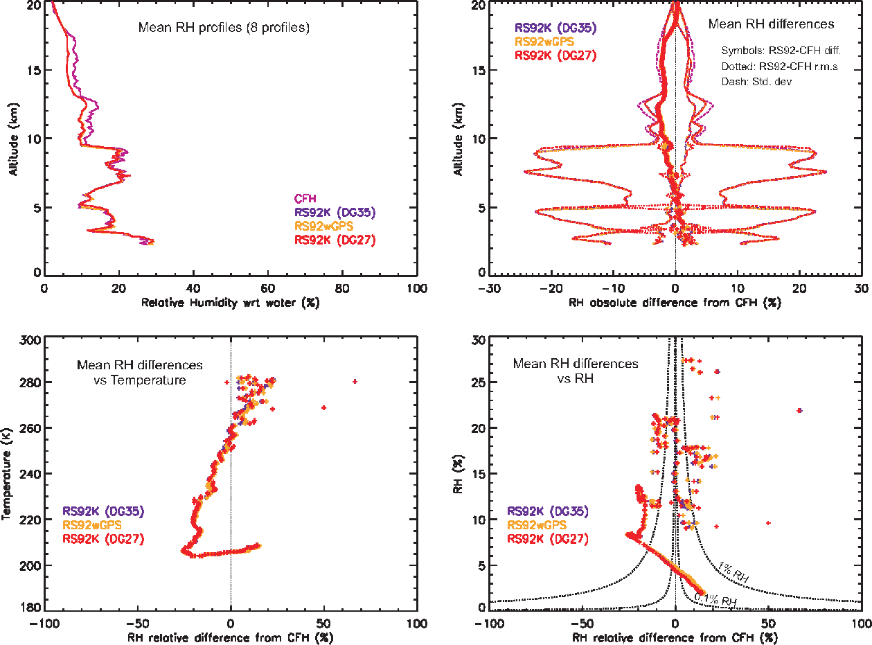
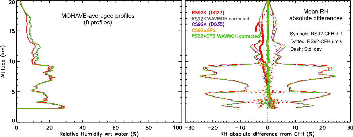
Figure 1 shows the comparison of the mean relative humidity (RH) profiles obtained from all profiles simultaneously measured by the RS92 radiosondes and the Cryogenic Frost-Point Hygrometer (CFH) during the MOHAVE campaign that took place at Table Mountain in October 2006. Eight of the ten CFH payloads included two RS92 radiosondes (one from JPL, one from a visiting GSFC group). The radiosonde data from each type of sonde were transmitted to two separate Vaisala ground-systems, referred to as “DG27” and “wGPS” in the figure. In October 2006, the Vaisala DIGICORA v2.7 was used by JPL to receive data from the JPL RS92K sondes, and the DIGICORA v3.5 was used by the visiting GSFC staff to receive data from the GSFC RS92 sondes (equipped with GPS). The datasets referred on the figure as “RS92K DG35” correspond to data received from R92K sondes on the JPL ground system, then re-processed by DG35 using the “Re-flight Simulation” capability of the GSFC software. This way the various versions of the Vaisala software could be cross-validated. Very little difference (<0.1%) was observed between the various processing versions of the Vaisala DIGICORA software. The main feature on figure 1 is the systematic dry bias of the RS92 compared to the CFH, taken as the reference. This bias has been observed before, and various empirical corrections (time-lag, temperature, solar radiation, etc.) have been developed. A correction of this type was applied to the MOHAVE and MOHAVE-II (October 2007) profiles and the results for MOHAVE are shown in Figure 2 (grey and green curves).
In 2007, the JPL Lidar Group upgraded their DIGICORA system to version 3.5. The entire dataset (2004-current) was re-processed with this new verision and the data are available upon request.